High-Accuracy GNSS for Esri Mobile Apps
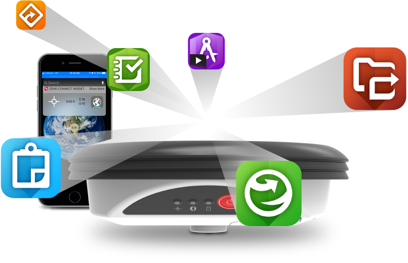
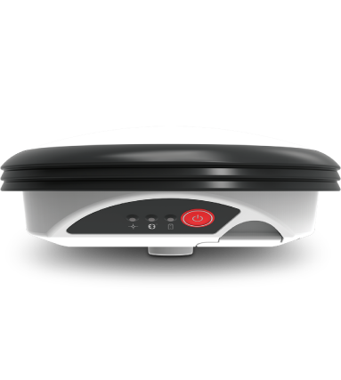
The leader in measurement technology, Leica Geosystems, provides accurate and reliable GNSS positioning to Esri’s mobile applications, like Esri Collector for ArcGIS. The Leica GG04 plus Smart Antenna is a ruggedized GNSS solution that can withstand harsh environments and works where our customers work. Each GNSS device is scalable, so our customers can upgrade the accuracy as well as GNSS constellation support as their projects demand.

Leica GG04 plus
Smart Antenna

The Leica GG04 plus Smart Antenna offers the ability to utilize a 3rd party Android, iOS or Windows device as the field collector.

Correction Source Configuration Accuracy
SBAS via WAAS Backpack or Pole Kit 90 cm or better
SBAS via Spot Lite PPP Backpack or Pole Kit 60 cm or better
DGNSS Backpack or Pole Kit 40 cm or better
SBAS via Spot Prime PPP Backpack or Pole Kit 10 cm or better
RTK Pole Kit 1 cm or better
Learn More

Leica Zeno Tab 2 Tablet

Looking to add a rugged Android tablet to your GG04 plus kit? Leica Geosystems offers the Zeno Tab 2, a field rugged Android 8.0 device with an 8” sunlight readable screen. The Zeno Tab 2 running Zeno Connect and your Esri Mobile app, will receive high-accuracy GNSS positioning from the GG04 plus.

Learn More

Leica Zeno Connect

The Leica Zeno Connect software is a configuration app that allows the user to define the real-time correction source, antenna settings and other related settings to provide high-accuracy GNSS positioning to 3rd party applications.

Learn More

Zeno Connect is available for download on the Google Play Store and the Apple App Store. For Windows Embedded Handheld or Windows 7/8/10 devices, please contact your local dealer or Leica Geosystems directly.

Esri ArcGIS for Field Mobility

Use the power of location to improve coordination and operational efficiency in field workforce activities. Reduce or even replace reliance on paper. Ensure that both field and office workers use the same authoritative data to reduce errors, boost productivity, and save money.

SmartNet Correction Services

Not only is Leica Geosystems capable of providing the hardware and software necessary to enable high-accuracy GNSS positioning to Esri Mobile apps, but we also can offer real-time internet-based correction services through SmartNet North America and HxGN SmartNet for corrections throughout the world.

Learn More